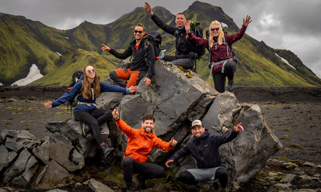
The Trans Canada Trail (TCT) is the longest thru-hike in the world. The trail crosses all Canadian provinces and has a total length of more than 28.000 kilometers. This thru-hike connects all three oceans around Canada: the Atlantic Ocean, the Pacific Ocean, and the Arctic Ocean. Along the way, you will pass 15,000 rural, city, and indigenous communities. Combine this with unique landscapes, a variety of seasons, and special experiences, and the TCT has everything that you are looking for in a (very) long-distance hike.
Endless possibilities
The TCT connects people with nature and with each other. No matter how old you are, where you’re from, or what your passion is: on this trail everybody is welcome. Due to its length, it is almost impossible to hike the entire trail in one go. Many hikers walk different sections at a time, which is easy to do because the TCT is a connection between various shorter long-distance trails. Did you know that this trail is not only suitable for hiking? Some parts of the trail can be done on a bike, in a canoe, on horseback, or even with skies!
North America’s toughest hiking trail
One of the most challenging sections of the TCT is the Canol Trail. This trail follows an abandoned pipeline from the second World War. Due to its remote location, length, and landscapes, this 355-kilometer-long thru-hike is a challenge for even the most experienced hikers. Most people need around three weeks to complete it, whilst carrying food, water, gear, and an inflatable raft to cross the rivers. Along the way, you can find five shelters in case of emergencies. These are located on miles 1, 8, 50, 71, and 100.

Hiking alongside old railways
A large part of the TCT runs alongside old railways. One of the nicest sections is the Newfoundland Trailway: an 880-kilometer-long trail that runs from east to west of Newfoundland. It is not the most technical trail, since the trail is mostly flat. However, the varies from loose sand to railroads, deep ponds, and loose rocks making it challenging differently. Due to the direction of the wind, this trail is best hiked from west to east.
Itijjagiaq Trail on Baffin Island
The Itijjagiaq Trail is 120 kilometers long and traverses thru the wilderness of Baffin Island. Again, this trail is very remote and thus requires proper preparation. The trail is not well-marked and in combination with the wild landscape, you need to be able to navigate with GPS. During the summer, the nature is amazing, whereas in winter the trail is almost impossible to see due to the snow. Along the way, you will find some simple huts for shelter.
Coastal pathways and crystal-clear waters
Several sections of the TCT are near, or even on top of, water. There is a long section that goes alongside Lake Superior, where you can take a kayak and paddle parts of the trail. If this is not your thing, you can opt for sections on land, such as the Kabeyun Trail or the Coastal Trail. Also, the 90-kilometer Celtic Shores Coastal Trail in Nova Scotia is mostly alongside the coastline. This is an easy and flat trail that takes you thru beautiful landscapes, cozy villages, and romantic beaches.
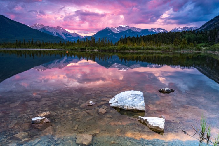
Paradise for hikers: the Canadian Rockies
One of the most popular parts of Canada is the Canadian Rockies. Several sections of the TCT cross this breathtaking area, among which the 80-kilometer-long High Rockies Trail. This trail connects Goat Creek to the boundaries of Banff National Park and Elk Pass on the border between Alberta and British Colombia. This area is spectacular and very diverse; one moment you hike in the forests and the next moment you are challenging yourself in mountainous regions. Especially the section of the Sparrowhawk Day Use Area to Buller Creek is very challenging but breathtaking at the same time!

Do not forget
Find our thru-hiking gear list here. Some items that you should not forget on the Trans Canada Trail are:
– Sleeping gear, such as a tent and a sleeping bag. During many sections, there are few to no accommodations options.
– GPS, since cell phone reception is limited and you will be dependent on the GPS to find your way and to send others your location in case of an emergency.
– Water filtration system.
– Backcountry skills are needed to succeed on the tough trail.
Best time to hike
The best time to hike the Trans Canda Trail depends on which sections you want to trek. Often, the most northern parts of the trail are blanketed in (a lot of) snow. If you want to avoid this, it is best to hike these parts during the summer. In early summer or late autumn, these areas have a higher chance of snowfall, and some sections of the trail may be closed. However, it is always possible to find a desirable section to hike.
Good to know
Before traveling to Canada, you need to request an eTA (Electronic Travel Authorization). This is a mandatory form you need to have before entering Canada without a visa. The eTA can be requested online. Make sure you arrange this on time, just in case there are some delays during the process. Next to this, the Trans Canada Trail crosses many National Parks, where in most cases you need an entry ticket. It, therefore, is important to make sure you have to right documentation before you begin your hike.
More info: Trans Canada Trail