Trail talk
Home / Trail talk / Szlak Karpacki
Trails
Need to know: Szlak Karpacki
- Shanna Bussink
- 17 December 2024

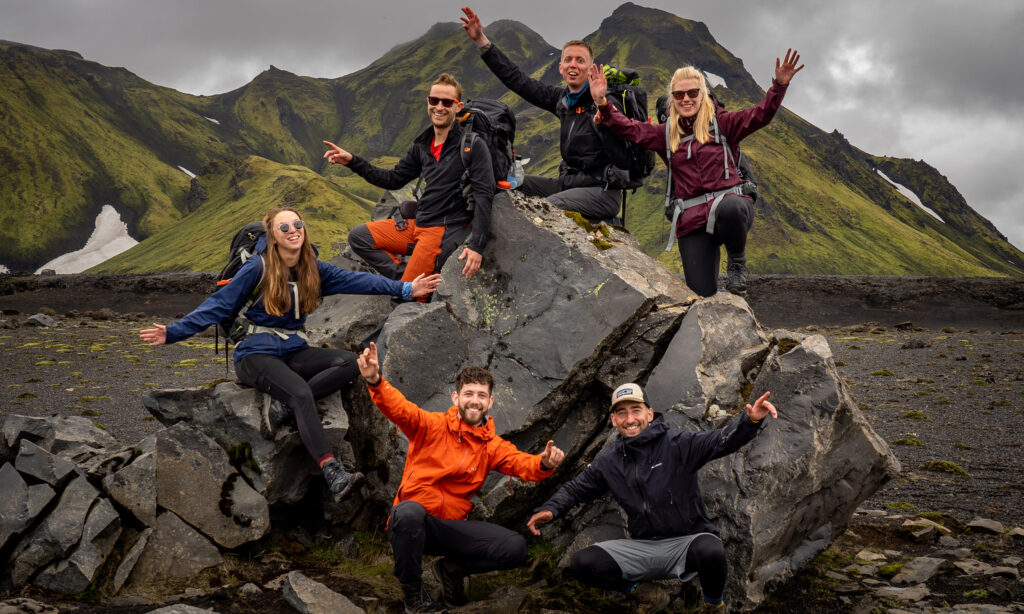
The Carpathian Trail (Szlak Karpacki) is Poland’s third-longest trekking route, stretching approximately 440 km (273 miles) from Przylasek near Rzeszów to Wołosate in the Bieszczady Mountains. This rugged and remote trail offers an immersive experience through Poland’s southeastern wilderness, making it a perfect adventure for experienced long-distance hikers.
Trail Overview
The Carpathian Trail traverses diverse landscapes, including dense forests, rolling hills, open countryside, and rugged mountains. With a cumulative elevation gain of about 147,390 meters (483,563 feet), the trail challenges hikers with its undulating terrain and occasional steep climbs. It’s a true backcountry experience with limited infrastructure and long stretches of unspoiled nature.
What to Expect
Solitude & Wilderness: The Carpathian Trail is known for its remote setting, providing a peaceful escape into nature. Expect to encounter few other hikers, even during peak season.
Trail Conditions: Some sections of the trail, particularly near the start, can be overgrown with nettles, thorny bushes, and muddy paths. Wearing protective clothing and sturdy boots is essential.
Accommodation: Hikers will find a mix of camping spots, mountain huts, and shelters, as well as occasional hotels and hostels in nearby towns. Be prepared for basic facilities in more remote sections.
Highlights
Historic Villages: The route passes through charming villages such as Dynów, offering a glimpse into the region’s cultural heritage.
Wild Landscapes: From crossing the San River multiple times to exploring the Pogórze Przemyskie Landscape Park, the trail showcases Poland’s wild and untamed nature.
Flora & Fauna: The Carpathian Trail is a haven for wildlife enthusiasts, with opportunities to spot deer, wild boars, and a variety of bird species.
Trail Tips
Navigation: Due to limited waymarking and overgrown sections, reliable maps and GPS navigation are crucial.
Preparation: Come prepared with adequate food, water, and camping gear, as resupply points are scarce along the way.
Best Time to Hike: Late spring to early autumn offers the best hiking conditions, though be ready for changing weather.
The Carpathian Trail is an unforgettable adventure for those seeking a raw and challenging trekking experience through Poland’s scenic southeastern frontier. It’s a journey into the heart of nature, where every step reveals something wild and beautiful.


The Stages
The Carpathian Trail (Szlak Karpacki) is divided in 22 stages. You can easily adapt the stages to your own preferences.
Stage 1: Rzeszów – Błażowa
22 km | 13,7 mi
Stage 2: Błażowa – Dynów
21 km | 13 mi
Stage 3: Dynów – Huta Brzuska
27 km | 16,8 mi
Stage 4: Huta Brzuska – Krasiczyn
19 km | 12 mi
Stage 5: Krasiczyn – Kalwaria Pacławska
29 km | 18 mi
Stage 6: Kalwaria Pacławska – Kwaszenina
26 km | 16 mi
Stage 7: Kwaszenina – Ustrzyki Dolne
16.8 km | 10 mi
Stage 8: Ustrzyki Dolne – Teleśnica Oszwarowa
12,5 km | 7,5 mi
Stage 9: Teleśnica Oszwarowa – Dwernik
29 km | 18 mi
Stage 10: Dwernik – Bereżki
13,5 km | 8 mi
Stage 11: Bereżki – Ustrzyki Górne
24 km | 15 mi
Stage 12: Ustrzyki Górne – Przełęcz pod Czerteżem
17 km | 10,5 mi
Stage 13: Przełęcz pod Czerteżem – Roztoki Górne
19 km | 12 mi
Stage 14: Roztoki Górne – Balnica
16 km | 10 mi
Stage 15: Balnica – Koniec Świata
17 km | 10,5 mi
Stage 16: Koniec Świata – Jasiel
24 km | 15 mi
Stage 17: Jasiel – Zydranowa
26 km | 16 mi
Stage 18: Zydranowa – Schron Baranie
15,5 km | 9,5 mi
Stage 19: Schron Baranie – Radocyna
23 km | 14,5 mi
Stage 20: Radocyna – Wysowa Zdrój
25 km | 15,5 mi
Stage 21: Wysowa Zdrój – Klimkówka
24 km | 15 mi
Stage 22: Klimkówka – Grybów
19 km | 12 mi
Accommodation
Bring your tent, on this trail there are not enough indoor sleeping places to hike hut to hut, but also it suits the wilderness experience much better. You will come across primitive huts and shelters as well, and you will pass some little villages where you can recover in B&B’s or hotels. If you want to stay overnight, it is advisable to make a reservation during the high season (July and August), especially in Ustrzyki Górne. If you don’t want to camp, you can find lodges and B&B going off trail, but keep in mind that it will add up quite some distance.
Camping is prohibited in National Parks. Be aware of wildlife.
Overnights in the mountain huts / accommodations per stage:
Stage 1: Rzeszów – Błażowa: B&B and lodges (or open shelter after 5 km)
Stage 2: Dynów: Hotel, hostel or campsite
Stage 3: Huta Brzuska: camp
Stage 4: Krasiczyn: hotel
Stage 5: Kalwaria Pacławska: hotel, hostel, campsite
Stage 6: Kwaszenina: apartment or hotel (Arłamów)
Stage 7: Ustrzyki Dolne: several options
Stage 8: Teleśnica Oszwarowa: camp
Stage 9: Dwernik: Mountain hut (Chata Socjologa), campsite, B&B
Stage 10: Bereżki: campsite
Stage 11: Ustrzyki Górne: several options
Stage 12: Przełęcz pod Czerteżem: shelter
Stage 13: Roztoki Górne: shelter, B&B
Stage 14: Balnica: mountain hut
Stage 15: Koniec Świata: mountain hut
Stage 16: Jasiel: campsite
Stage 17: Zydranowa: mountain hut
Stage 18: Schron Baranie: shelter
Stage 19: Radocyna: campsite
Stage 20: Wysowa Zdrój: several options
Stage 21: Klimkówka: camp
Stage 22: Grybów: several options
More information: PTTK.


Good to know
During the Russia-Ukraine war you can be checked regularly by border patrol at the Ukraine border stages. They will check your passport and make some calls, which can take some time. Also make sure your roaming on your phone is off, since the Ukraine network is expensive. Staying for the night in or camping at the primitive huts Chata Socjologa and Schronisko na Końcu Świata is recommended. Phones are not allowed inside, since there is only candlelight, and the white light can be disturbing.
Cell reception can be sporadic at a lot of stages.
The trail is well marked, but with some bushwacking it is not uncommon to get lost every now and then. Although chances are small, you could encounter wildlife like bears, lynxes and wolves. You are hiking in wilderness area, so be aware of wildlife. Pack your food properly and know what to do in case of an encounter.
You can download the app Ratunek (choose Górne for ‘mountain area’ after downloading). Then you have an emergency button on your phone, just in case. Bring your trekking poles, as the trail can be muddy after rainy days.
There are ATMs available in Rzeszów, Dynów, Ustrzyki Dolne, Ustrzyki Gorne, Wysowa Zdrój and Grybów. Many places accept card payments.
Poland is part of the United Nations and a member of the World Trade Organization, OECD, NATO, and the European Union, but has it’s own currency; Złoty.
Request a trekkers pass at the PTTK office: you can collect stamps and earn beautiful badges.
Useful links
Apps:
Polish Map: link
Safety: Ratunek
Accomodation search: PTTK
More information:
Hiken begint hier
Poland Tourism Organisation
PTTK
Facebookgroup of this trail: Niebieskie Szlak Karpacki
Useful maps and overwiew:
GPX: Hiking Trails