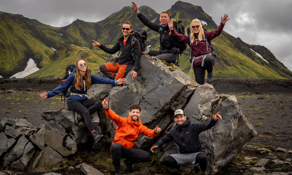

The HexaTrek is a 3034-kilometer hiking trail through France. It connects 14 of the most beautiful national parks and crosses France from the Vosges to the Pyrenees. The path follows the highest mountain regions of the country, often nicknamed “l’Hexagone” for its hexagonal shape, joining together some of the most emblematic summits, natural wonders, and wildest places.
47 Great Hiking GR® trails have been brought together in a single path to create this thru-hike. Stopping off in the most picturesque villages, HexaTrek is a journey into the wilderness, tradition, history, and into French culture.

The Great East (Vosges – Doubs – Jura)
670 kilometers – 21.200m
This mid-mountain stage is incredibly diverse and rich in cultural heritage. With one of the highest densities of castles per square kilometer in the world, you will come across numerous ruins that bear witness to the region’s tumultuous history. “La route des vins”, the local gastronomy, and the picturesque villages of Alsace will awaken all your senses.
Northern Alps (Haute Savoie – Vanoise – Beaufortain)
382 kilometers – 22.000m
A crossing in the heart of the most beautiful mountain landscapes, in the center of the Alps.
Stage 2 of the HexaTrek is an immersion at the highest summits. Many glaciers, high mountain lakes, and lots of cheese!
The Northern Alps are known to all for their flourishing ski resorts and those who have taken the opposite route of visiting them in the summer season know a completely different side of this emblematic range.
Southern Alps (Ecrins – Belledonne – Vercors)
497 kilometers – 26.800m
These mountains are similar to the Northern Alps, but with the added bonus of sunshine. The Hautes-Alpes is a paradise for hikers who venture there. The difference in altitude per km of this stage is one of the highest in the HexaTrek. It is a difficult stage with tricky sections, but a guaranteed immersion in nature.
Less touristy than its closest neighbor, the Hautes-Alpes are discovered during this great crossing before joining the Pre-Alps, the Vercors, and the Baronnies region.

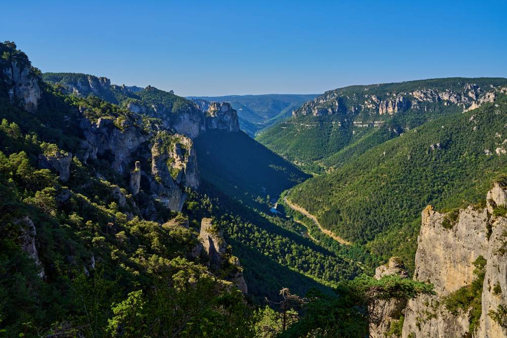
Gorges & Causses (Cevennes – Tarn – Languedoc)
514 kilometers – 14.300m
This region of south-central France is full of surprises. Here, time and water have shaped the landscape and dug deep gorges. Creating high plateaux between the junctions of these rivers, this contrast offers HexaTrek hikers incredible views of the surroundings. This is a stage that will refresh long-distance hikers by allowing almost daily bathing in these natural water reserves.
Eastern Pyrenees (Catalogne – Ariege – Central Pyrénées)
532 kilometers – 30.600m
Stage 5 will take you along the summits of the Eastern Pyrenees. The itinerary crosses the borders between France, Andorra, and Spain, remaining in the heart of the Pyrenean range. The forests of the Ariège and the Pyrenean hinterland offer breathtaking landscapes to hikers.
Western Pyrennes (National Park, Bearn, Basque)
437 kilometers – 22.600m
The highest peaks in the Pyrenees are found here. Hikers can expect a significant difference in altitude. Still, their efforts will not be in vain as they will be rewarded by incredible landscapes where the splendor of nature matches the violence of the ridges. The last stage in the North-South direction will leave the HexaTrek hikers with one of the most beautiful memories of the trail.
This is also the first stage in the South-North direction and will provide a fantastic opening for the months of hiking to follow.
Good to know
Do not forget
The HexaTrek, like any long-distance trek, has a very dialed-in packing list. Over 3000 kilometers of hiking will have you questioning every single item you carry! Check out our thru-hike gear list here, and find the specific breakdown for HexaTrek packing here.
When to go
There are a few factors that will help you decide when to hike the HexaTrek, like if you’ll journey NoBo or SoBo. The official website has more information on how to decide which direction to take.
Navigation
Hexatrek has its own mobile app that will allow hikers to 2500 points of interest along the trail. The app works entirely offline and you’re able to download maps for each stage of the trail as you go. The app will tell you about safe bivouac spots, must-sees, villages, accommodations, restaurants and more. This is a great resource!
You can also find an alternative itinerary by the HRP (Haute Route des Pyrénées) available in the app.
Useful links