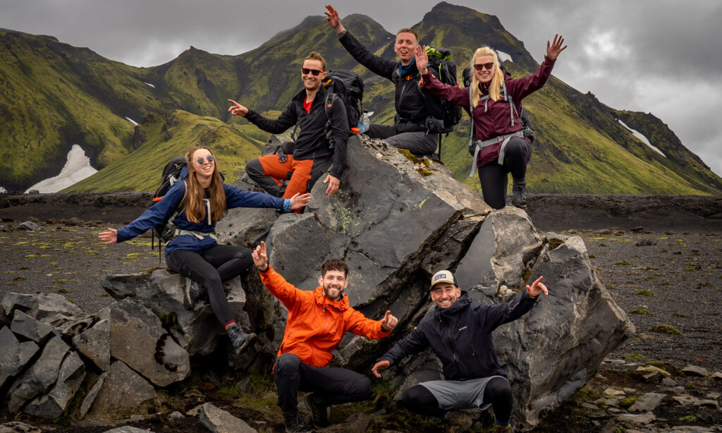
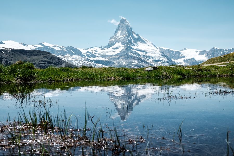
Anyone considering hiking a long-distance hike in Switzerland will come across the Walker’s Haute Route. For many people, it’s the most beautiful trail in the Alps. The original route starts in Chamonix, where you have views of the highest mountain in Western Europe: Mont Blanc (4808 meters). After 227 kilometers, 11 mountain passes, 28,000 altimeters, and approximately two weeks of walking, the Haute Route ends in Zermatt at the base of the Matterhorn (4478 meters).
Originally the Haute Route was a ski route between Chamonix and Zermatt. However, when hiking trails started to develop in the 20th century, the trail was formed to make it easier for hikers to walk from Chamonix to Zermatt without climbing above 3000 meters. This trail became the Walker’s Haute Route as we know it today. The trail has many variations and plenty of possibilities to add or remove sections as you wish. This allows you to create your own version of the Walker’s Haute Route.
From France to Switzerland
Despite the association with Chamonix, the Walker’s Haute Route starts in a little village called Le Tour in France. If you begin your hike here, the trail starts relatively easy, allowing your body to get used to hiking in the mountains. De Col de Balme (2195 meters) is the easiest of the eleven mountain passes you will encounter, and via this pass is how you enter Switzerland. Through the village of Trient, you hike over the very steep and rocky Fenêtre d’Arpette to Champex-Lac. From here you slowly descend towards the historical town of Sembrancher. Via the villages La Châble and Verbier, you will climb towards the Bagnes Valley and Cabane du Mont Fort (2457 metres). Here you can enjoy the views of the Combin massive from the mountain huts.

From Cabane du Mont Fort to La Sage
The Cabane du Mont Fort is the start of the more challenging part of the trail. From here to Arolla you will hike 32 kilometers, more than 3700 altimeters and four mountain passes in just two days! The views on the Grand Combin and the remote area between Col de Termin (2647 meters) and Col de Prafleuri (2985 meters) are amazing. On top of the Col de Prafleuri, you will see the Cabane de Prafleuri (2660 meters) in the distance. From here it is another hour of walking to Lac des Dix. This lake has a volume of more than 400 million cubic meters of water and is one of the largest water reservoirs in Europe.
The last pass you will cross is the Pas de Chèvres (2854 metres). This pass is known for its straight iron ladders you have to use to reach the top. The view will be spectacular! On your left, you can see the Pigne d’Arolla (3796 meters), on the other side of the valley the Cabane de Dix (2928 meters), and on your right Lac des Dix. The descent towards Arolla from Pas de Chèvres is across many green pastures. If you watch closely, you will see the pointy tip of the Aiguille de la Tsa (3668 meters) on the other side of the valley. In Arolla, you can re-stock your food supplies. Two small shops sell essential products. Next, you will continue to descend towards La Sage, where you can relax and enjoy the experiences you gained.
Towards the Matterhorn
After a relatively easy part of the trail, the climbing starts again. This time you start in La Sage and climb to Col du Tsaté (2886 meters). On the other side of this pass lies another water reservoir, Lac de Moiry. Across the valley, you can find the mountain hut Cabane de Moiry (2825 meters). This hut is in a magnificent place near the Moiry Glacier. The enormous glass windows of the hut allow you to soak in the amazing views.
The Matterhorn is getting closer now. After de Col de la Forcletta (2875 meters), you will cross a language barrier. From now on, you are in the German-speaking part of Switzerland. “Bonjour” is swapped for “Gruezi.” During the descent towards Gruben, you can see the high tops of the Weisshorn (4505 meters) and the Bishorn (4153 meters) in the southeast. On the part between Gruben to St. Niklaus, you pass the last mountain pass of the Walker’s Haute Route: the Augsbordpas (2897 meters). From here, you walk towards Matterdal, the valley next to the Matterhorn. The final part of the trail takes you through this valley towards Zermatt: the highlight and the end point of the trail with views of the Matterhorn (4478 meters).
Do not forget
We’ve put together a general packing list for thru-hikes, but there are a few things to make sure to include for this trail.
– Layered clothing: the weather in the Alps can be unpredictable, so you need to be prepared for the different circumstances. Take a beanie and gloves to keep yourself warm if needed.
– Hiking poles to minimize the impact on your knees.
– (Sleeping bag) liner for the nights in the mountain huts.
– Sunscreen and sunglasses.
– Strong and sturdy hiking shoes.
Best time to hike
The best time to hike the Walker’s Haute Route is from mid-June to mid-September. The most optimal period is from mid-July to the end of August. During this period, the weather is the most suitable and most mountain passes will be snow free. However, remember that weather in the mountains can always be unpredictable. When there has been snow in late spring, there will still be snow on the higher passes in July. And by September, the weather can be precarious.
Good to know
The Walker’s Haute Route is a popular hike. Not only Europeans but also Americans and Asians travel to Switzerland to hike this trail. Therefore, it is important to book your accommodation in the mountain huts and hostels beforehand (especially during the high season).
Useful links
More info: Guide