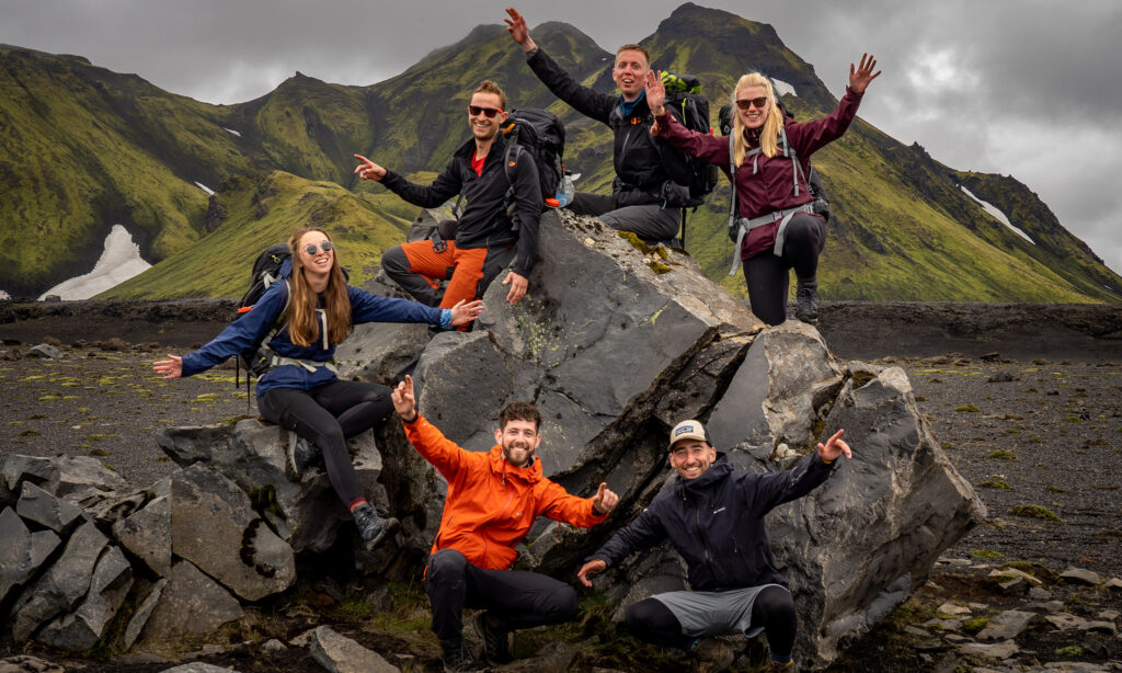

The West Highland Way is a 154-kilometer (96-mile) long-distance trail in Scotland. It runs from Milngavie, a suburb of Glasgow, to Fort William in the Scottish Highlands. The trail passes through some of Scotland’s most breathtaking landscapes, including Loch Lomond, Rannoch Moor, and Glencoe. The West Highland Way is considered one of the best long-distance walks in the UK and attracts thousands of visitors every year from all over the world. The route is well-marked and well-maintained, making it suitable for walkers of all abilities. The trail also passes through several charming villages and towns, offering a glimpse into traditional Scottish culture. Whether you’re an experienced hiker or just a beginner, the West Highland Way will amaze you, and it is a true European classic.
Starting in Milngavie
The WHW starts in the suburbs of Glasgow, a small town that has a lot of typical British flair, called Milngavie. The trailhead is right in the center of the village and only a few hundred meters away from the local train station, so it’s hard to miss. From the town square, you’ll first take a leisurely walk through the local parks before heading north to lesser populated regions of Scotland. The first section of the trail is mostly dominated by farmland. If you are starting later in the day it could be a problem to find a good spot for wild camping for the first 15 kilometers because you are going to be surrounded by fenced pastures where it’s not allowed to camp, but there are a few possible spots.
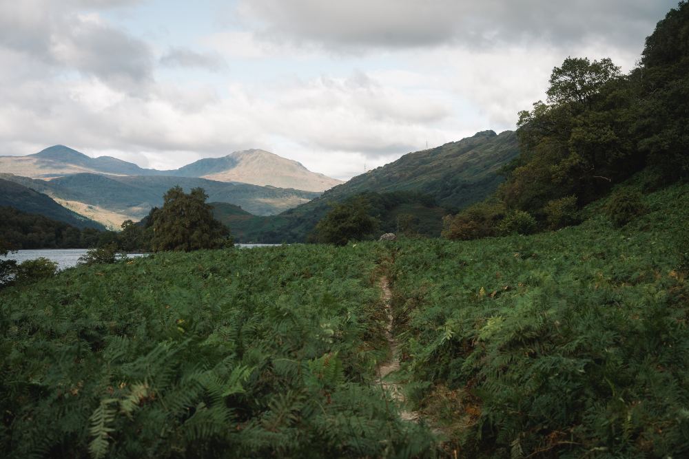
When you leave the town of Drymen behind, you will enter Loch Lomond National Park. After a short stretch of forest, you can soon see the prominent landmark Conic Hill. This is the first major climb of the trail, but it winds pleasantly through the hills, so it never gets very steep. If the weather plays along you can see most of the largest Lake of Scotland, Loch Lomond which is 71km².
Along Loch Lomond
The descent from Conic Hill will guide you into Balmaha, a small town that is perfect for a lunch break or an overnight stay. From now on the vibe of the trail changes a bit as you enter a more touristy area and the scenery is changing as well. For the next 30 kilometers, you will keep hiking directly along the lakeshore. You will pass by large beaches and many streams flowing down into the lake.
But soon the beaches will disappear and cliffs will form on the shore. You will have the choice if you want to stay above on easier terrain or if you want to follow the shoreline more closely. If you choose the latter you will find yourself on more technical terrain which will slow you down. One of the highlights of this section is the breathtaking waterfall at Inversnaid. The West Highland Way route takes you across a footbridge over the waterfall, which cascades down to Loch Lomond. From here on out it’s getting more remote and soon you will be leaving Loch Lomond behind you.
Through the highlands
The last half of the trail will take you to a new and different landscape, a landscape with towering mountains and gorges. You will follow the rivers Falloch and Fillan passing through open fields and small villages until you reach Tyndrum. This is the last town with shopping options for the next 45 kilometers (28 miles), so if you need any supplies this is the time to get them. In the coming section, you will be in the most beautiful and remote part of the trail.
Passing right below the beautiful Buachaille Etive Mòr Mountain in Glencoe, you will go up the devil’s staircase. This sounds worse than it is, mainly because it serpentines over the highest pass on the way. If the weather hits, it will hit you pretty hard in this section, because there isn’t any natural shelter. From the devil’s staircase, you will be descending into Kinlochleven, which is a true trail town. There is a shop to resupply, and a number of pubs which will be crowded with WHW Hikers as soon as the sun sets.

Kinlochleven to Fort William
This final section begins with a steep climb out of Kinlochleven. For the last kilometers, you will be surrounded by the highest mountains in the UK, including the highest of them, Ben Nevis. It is 1345 meters high and the WHW passes right at its foot. Many people add the ascent to their hike, right when they pass it or after they have reached Fort William. If you decide to conquer this mountain, it will add 1330 hm and 14 kilometers to your hike. From Ben Nevis, Fort William and the finish line of the West Highland Way are right around the corner.
Good to know
What to bring?
Due to the more smooth terrain of the trail, you don’t need to bring anything special. Using poles and trail running shoes will help you with comfort on some of the longer road stretches. However, Scotland is known for two things, the weather and the midges. For this trail, you have to be really dialed in with your rain gear and need to know how you keep your bag dry. And for the midges, you should bring a midge-proof head net from spring to autumn, and maybe even a repellent for the summer months. You can find our full packing lists for thru-hikes here.
How long does it take?
The official itinerary is 8 days, but that should only be applicable if you are a beginner or want to take your time. For more experienced hikers, it is recommended to plan for 6 days. Especially for campers, you can go at your own pace, you’ll find a spot at every other mile.
These are the official stages for a 6-day itinerary:
- Day 1: Milngavie – Balmaha | 32 km
- Day 2: Balmaha – Inversnaid | 23 km
- Day 3: Inversnaid – Crianlarich | 21 km
- Day 4: Crianlarich – Inveroran | 24 km
- Day 5: Inveroran – Kinlochleven | 30 km
- Day 6: Kinlochleven – Fort William | 24 km
Where to sleep?
On the WHW you can live like the royals or you can curl up in the grass at night. There are plenty of guesthouses, hotels, bed and breakfasts, and campsites directly at the trail. A few of them you can find here.
However, Scotland is one of the few countries in Europe where wild camping is allowed. Of course, you have to follow the Scottish Outdoor Access Code. Places to wild camp are pretty easy to find, especially in the more remote areas. In many places, you can even find fireplaces and cleared areas for a tent. Only in the Loch Lomond National Park, there are the so-called Camping Management Bylaws to protect nature from March to September. In these places, wild camping is prohibited for WHW walkers which mainly includes the eastern shore of Loch Lomond. But even there you can find campsites to stay at. You can find out more here.
Best travel time
Basically, you can hike the WHW every month of the year. From November to March the weather will be a bit harsher, and depending on the temperatures you could find yourself in a snowstorm, so you should definitely know what you are doing and should be equipped for icy trails. But most of the time it will be wet and windy in the winter months.
May and June are the most popular months, so you definitely should be booking any accommodation you may need in advance. For the rest of summer, the midges are pretty bad, but at least the weather is more stable.
In our opinion, the sweet spot is the last two weeks of September. The midges aren’t as bad and the days are still long enough to keep up the pace. But be prepared, you can experience the whole weather range then as well.
Getting to the trailhead and back
Because Glasgow is the biggest city in Scotland, it is pretty easy to reach by plane. From the airport, you can take a shuttle to the Queen Street train station. There you can catch a 20 min train ride to Milngavie. The trailhead is signposted from there.
Once you reach Fort William, there are several options to get back to Glasgow. We took the cheapest option: the bus. Line 914 takes you from Fort William to the Central Bus Station of Glasgow in 3 hours. We would recommend buying tickets at least the day before so you have a guaranteed seat.
Water and Food
Along the trail, you will find plenty of options for a meal or a resupply on a daily basis. Finding water won’t be a problem in any season, but make sure to filter it and try to use the smaller streams coming from the mountains. There is a lot of agriculture, which can contaminate some streams. Irregularly you will also pass hiker boxes, where you can get snacks or cold drinks for a small fee.