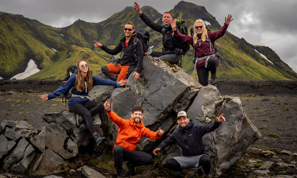

The Appalachian Trail (AT) is the longest thru-hike in the world and one of the three most famous thru-hikes in the United States. Another name for this trail is the green tunnel because almost the entire trail runs through the forest. The trail runs from Katahdin National Park in the northern state of Maine to the top of Springer Mountain in northern Georgia. It crosses no less than fourteen states and six national parks through the Appalachian Mountains in the eastern US. Most hikers complete the trail northbound in about six months, starting in southern Georgia. The die-hards run ‘southbound’ and start in Maine with the roughest parts. Despite the 157,000 vertical meters, the highest peak is ‘only’ 2025m. On the trail, you will find simple shelters every 15 to 20 kilometers where you can rest or spend the night.
Maine section
The Maine section is the roughest and most difficult part of the AT. This is due to the (often) bad weather conditions. It can be cold, windy, and very rainy. Dress well in layers and make sure you bring good wind and waterproof clothing. The start, or more often end, is on Katahdin. It is a symbolic point because it towers far above the landscape and you can look out over the surrounding area (when the weather is nice). The AT takes you in Maine through remote and rugged areas. The height difference is not too bad, but the paths are very steep and challenging due to the many rocks. It often happens that you will only encounter wildlife for days. You have a good chance of spotting moose, deer, or even a black bear. Don’t forget to bring your bear spray and learn how to properly store food. Before you can leave the roughest state behind, you must first conquer the hardest mile of the AT, found at Mahoosuc Notch. The trail runs between two mountains and is dotted with boulders and rocks that you have to climb over, under, and along.

New Hampshire & Vermont sections
From the harsh, but satisfying Maine segment, you’ll enter New Hampshire and Vermont. This section of the AT presents similar challenges to Maine. The most difficult part of New Hampshire is the trail’s second-highest point: Mt Washington. This peak is located in the impressive Presidential Range. The challenge with these climbs is not the difficulty of the climb itself, but again the weather conditions. Here you walk hundreds of meters above the tree line, so the icy wind will make it feel much cooler than it is. So get bring your layers, even in summer!
The landscape consists largely of volcanic rock with fissures and rocks. You walk through the Mahoosuc Range just before the border with Maine. From here you can walk beautiful side trails and loops of several kilometers to waterfalls and lakes. A great example of this is the Dryad Falls loop. Before crossing the Connecticut River, which is the border between New Hampshire and Vermont, the trail will take you through volcanic areas with beautiful rock formations. This area is popular with off-piste skiers. The trail through Vermont is largely similar to the section around the Connecticut River and is characterized by limited elevation, interspersed with a few climbs, and consists mainly of forests.
Massachusetts & Connecticut sections
The trail also takes you along western Massachusetts through the Lake District, with its many lakes and beautiful hills. This is a beautiful, yet not too intense part of the route. Because of this, it’s much busier here, Greylock Mountain is a popular hike for day-trippers. On the way to Connecticut, you walk through wooded areas and past several waterfalls. In Connecticut, you come to the 705-meter hill Bear Mountain. The rest of the stretch through this state consists of lower-lying forests with nice hiking trails.
New York & New Jersey sections
The more than 250 kilometers through these states are not known as the most impressive part of the Appalachian Trail, but they are great for taking it easy. The trail leads through forests of marble and granite rocks and over the top of Bear Mountain at 391 meters. Don’t expect the rugged wilderness or many places for wild camping here; it can get quite busy here with (day-trip) people. The trail does lead along rolling hills with beautiful panoramas of the forest landscape and rivers.
Pennsylvania section
The Appalachian Trail runs across the ridges in the Blue and South Mountains in Pennsylvania. After climbing Mt Minsi, the route goes almost entirely over the Blue Mountain Ridge for 150 kilometers at an altitude of 400 to 450 meters. Despite the lack of climbs, this is an impressive walk with plunging cliffs and a breathtaking view from Devil’s Pulpit over the river. After climbing Cove Mountain, the South Mountains begin and lead over a ridge but with more climbs. The South Mountains run to the Mason-Dixon border to the southern portion of the trail.

Maryland & Virginia sections
The southern portion of the trail is very diverse. You climb Quirauk Mountain, the highest point in Maryland, at 655 meters. The trail also takes you past Crampton Gap, a memorable American Civil War site, and through Shenandoah National Park past ridges and other landmarks. In 150 kilometers you cross the national park. It is well-maintained and very busy at peak times. The Appalachian Trail passes many waterfalls such as the White Oak Run, Big Falls, and Hawksbill Mountain at 1,234 meters.
Here you walk between walls created from former lava flows. Go over the Blue Ridge ledge and pass the ‘Religious Range’ with peaks like The Little Priest along the way. Be sure to stop at Fuller Rock to enjoy beautiful vistas. The trail passes the village of Daleville, popular with thru-hikers to recover from civilization and take a ZERO. In Mount Rogers Park, the trail rises again above 1,500 meters and features challenging climbs such as Mt Rogers, the highest point in Virginia. On the border with Tennessee is the town of Damascus, nicknamed Trailtown USA because of the many facilities for hikers.
Tennessee, North Carolina & Georgia sections
If you walk southbound, the first 725 kilometers are through diverse and mountainous terrains with dozens of climbs, such as Iron Mountain behind which Watauga Lake lies. This is a beautiful stretch where the trail crosses a dam, and has waterfalls and Pond Mountain with a campsite at the top!
Perhaps the most beautiful part of the trail is on the border of Tennessee and North Carolina: The Great Smokey Mountains. This national park is rich in flora and fauna, streams, and beautiful climbs with the highest point on the entire trail, the Clingman’s Dome at 2025 meters. Here, the trail leads along an elevated ridge and over peaks with great panoramas from observation towers and mountain peaks. The steepest parts are in the south of the park. At the Fontana Dam, the Smokey Mountains end and the challenging Nantahala National Forest begins. It’s a wild and difficult area, with abrupt climbs and steep sections despite being lower than the Smokey Mountains. The steeper sections such as the Wesser Bald and Standing Indian are rewarded with beautiful views during the ascent and at the top. From Standing Indian, you can already see the last state of Georgia. The stretch through the Appalachian Forest is wild, relatively quiet and less extreme. Scenic views include Tray and Blood Mountain, as does a stop at Soto Falls. The trail starts at Springer Mountain, a peak that rewards you with beautiful views.
More about the Appalachian Trail
Good to know
The Appalachian Trail is a challenging and demanding long-distance hike. Prepare well! The weather in the mountains can change quickly, so keep a close eye on it. On the trail, you’re often on your own. Keep in mind that you may encounter bears and take precautions when you pack and hide your food. Bring bear spray and always be informed by other thru-hikers and trail angels about the conditions on the route. Most hikers walk the trail from south to north, starting between mid-April and early May. Your goal is to complete the trail without getting snowed in during the mountain sections, bringing your journey to an untimely end.
Useful links
More info: Appalachian Trail